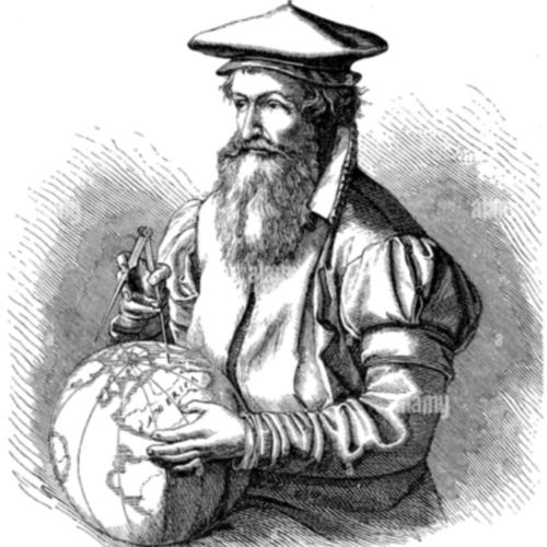
Born in 1512 in Rupelmonde, in what is now Belgium, this individual became one of the most important figures in (1) . Trained in mathematics, geography, and astronomy, they developed groundbreaking methods for (2) during the Renaissance. Their work combined scientific precision with artistic skill, helping to improve (3) at a time when global exploration was expanding rapidly.
Their most significant achievement came in the 16th century when they devised a new map (4) that allowed navigators to plot straight-line courses across the globe. This innovation revolutionized (5) travel, making long-distance navigation more accurate and practical. Although not widely adopted at first, this projection became the foundation for modern world (6) and remains in use today.
Beyond cartography, they were also skilled in instrument-making, (7) , and typography, producing globes, celestial charts, and atlases that shaped geographic knowledge for centuries. Their contributions extended beyond technical advancements, as they played a role in organizing (8) data in ways that influenced both scholars and explorers.
Passing away in 1594, they left behind a body of work that transformed the way the world was visualized. Their approach to (9) set new standards in cartography, influencing generations of mapmakers. The techniques they pioneered continue to impact geography, navigation, and the way people (10) the world today.
Now check your answers:
Who is this baiography about?
If you don't know their identity, click:
▶ Click to show the transcript and the correct answers.
Born in 1512 in Rupelmonde, in what is now Belgium, this individual became one of the most important figures in (1) cartography. Trained in mathematics, geography, and astronomy, they developed groundbreaking methods for (2) mapmaking during the Renaissance. Their work combined scientific precision with artistic skill, helping to improve (3) navigation at a time when global exploration was expanding rapidly.
Their most significant achievement came in the 16th century when they devised a new map (4) projection that allowed navigators to plot straight-line courses across the globe. This innovation revolutionized (5) maritime travel, making long-distance navigation more accurate and practical. Although not widely adopted at first, this projection became the foundation for modern world (6) maps and remains in use today.
Beyond cartography, they were also skilled in instrument-making, (7) engraving, and typography, producing globes, celestial charts, and atlases that shaped geographic knowledge for centuries. Their contributions extended beyond technical advancements, as they played a role in organizing (8) geographical data in ways that influenced both scholars and explorers.
Passing away in 1594, they left behind a body of work that transformed the way the world was visualized. Their approach to (9) mapping set new standards in cartography, influencing generations of mapmakers. The techniques they pioneered continue to impact geography, navigation, and the way people (10) perceive the world today.
▶ Click to show questions for discussion.
What were Gerardus Mercator’s most significant contributions to cartography, and how did his work revolutionize mapmaking?
How does the Mercator projection work, and why was it particularly useful for navigation during the Age of Exploration?
What were the limitations and criticisms of the Mercator projection, particularly in representing the sizes of landmasses?
How did Mercator’s creation of the term “atlas” influence the way geographical knowledge was compiled and presented?
What is Gerardus Mercator’s legacy in geography and cartography, and how does his work continue to impact modern mapmaking?